Sunday, September 22, 2013

Chesapeake Bay Bridge-Tunnel!


We made our trip to Jamestown even more exciting by taking the long way home across the Chesapeake Bay Bridge-Tunnel!  Yes, we've not only been across the Chesapeake, we've now also been under it!  From Jamestown, we went southeast along a peninsula in Virginia where everyone lives with a view of water.  Once across the bay, we drove up the Eastern Shores, with a quick stop for a dip in the Atlantic!  So lovely!  I'm excited to take you on the virtual ride.... 

If only you had a map?  Ta daaa!  We live at the A and D, the beginning and the end.  Jamestown is down by the B, and our little Atlantic Adventure is marked by a C.  The Bridge-Tunnel is at the bottom of our route, taking us across twenty miles of water.


View Larger Map


Our drive along Virginia's southern penninsula didn't result in any decent drive-by photos.  But here is where we began our trip across the huge bridge....

Leaving the western part of Virginia state

looking ahead - for a better view of the whole thing click here

There were many ocean liners waiting to come to port

When we had crossed several miles of bridge, we came to a man-made rocky island, about five acres in size.  On this island was a long fishing pier, where many people were keeping their eyes on several fishing lines at once.  In talking to a few fishermen, we learned that one line was for catching bait (bluefish) and the others were for using the bluefish to catch shark!  Getting a shark is a regular event here - my disbelief was quickly chased away when the fishermen started opening their 'big catch' photos for me on their phones!  I could have stayed on that pier for hours, out in the middle of the water, literally, with the stories and sun and camaraderie....  


The fishing pier
The view of the island from the fishing pier. (Most of the fishermen were behind me.)
In the building is a restaurant, bathrooms, some info.  We had come from the right (west).

We watched a pod of dolphins swim by!  (Can you see them halfway up between the bottom of the
photo and the boats?  Delightfully close when using binoculars!  But little specks of white here.)


a bit closer!


So here, at this first island, is where the tunnel starts.  Off and on across the bay, we went underground.... er, I mean under water... so that boats could freely pass.  After visiting the fishing pier (and the restaurant), we drove down into the tunnel and came up again at the next rock island in the distance.
looking down at the entrance to the tunnel!

After a few tunnels and many bridges, we crossed twenty miles of the Chesapeake Bay and arrived on the Eastern Shores, a narrow piece of land that belongs to Virginia, Maryland and Deleware!


It was getting late, but we really wanted to swim in the Atlantic Ocean!  We had been longing to see the wildlife preserves and national seashores in this area!

On our way, we took a drive-by photo of NASA.  Wish we could have taken the time to explore their visitor center!  Next time!

NASA (the spot from where the last two launches were sent in the last few weeks)

(Meanwhile, in our van, Aidan and Owen were laughing pretty hard at Owen's Bill Cosby talks)
gorgeous, gorgeous wildlife preserves


Soon the area turned touristy, and the marshes were filled with billboards.
(See how they go all the way down the road?)

A great visitor's center at the National Seashore!  And another stamp in the Passport! 

Into the Atlantic!


my girl
jumping the waves!

Marijka and Arthur had lots of fun closer to shore


Gord and Jon stayed on higher ground.  :)

We really didn't do this place justice!  In the short time we had, we saw several egrets and even a quick glance at the wild ponies that live in the preserve.  

egret!
(The ponies are behind the trees on the left.  The pictures we've seen of the wild
ponies in the area are spectacular!)


 We need an excuse to go back!!!  Anyone want to come check it out with us????

Saturday, September 21, 2013

The Settlement of Jamestown (Part II)


Our afternoon was spent at a place called Jamestown Settlement, a living history museum started in the 1950s.  We first came to a large, lovely building filled with intriguing displays of the history of the area.  Our children were not in the mood to stand and study or read and learn, so we took only a quick glance at the exhibits, making a hopeful mental plan to come back to enjoy them later.  (We didn't have time.  Guess we have to go back!)

Each section of this place has a tour guide.  (There are three sections: the Indian Village, the Colonial Settlement and the Shipyard.)  When we told our collective group of kids that we were meeting up with a tour guide, there was a universal sigh of disappointment.  But when our guide, a quiet-spoken but fairly big guy, dressed in the clothes of the Powhatan tribe (i.e. not much clothing, plenty of face paint, and a feather arrow through his ear), the kids were suddenly attentive and interested!  :)


Our guide took us to the Indian village and shared plenty of interesting anecdotes and information.  Then he allowed everyone time to play with everything!  We could lay down on the furs, handle the clay pots, grind our own corn, dig out canoes...lots of fun!

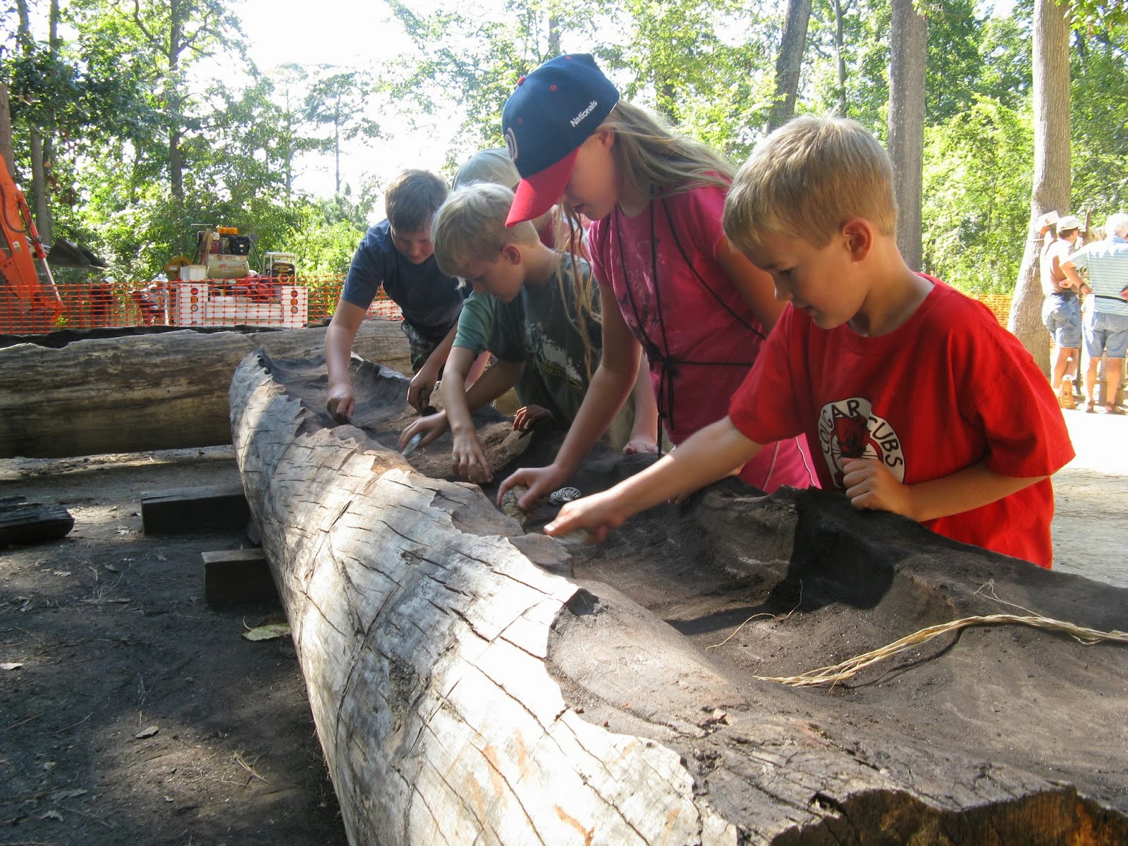
digging a canoe using clam shells


pounding corn


Seriously!?  They let us handle all the clay pots? 
(It was cool to learn how the shape of each pot was based on what was to be
cooked or stored in it; different styles for different kinds of fire, etc.)
Arthur and Sam playing one of the games.


I was especially interested in the information we were given about the Powhatan homes.  A fire would constantly burn in the middle of the wigwam.  The doors were intentionally short (around four feet) so the smoke would stay in the house.  Food, hanging from the ceiling, would stay preserved, the reeds of the walls would stay dry, and people would enter to shake off some of the humidity.  Even in summer, to have some dry heat would really help cool bodies down.  The smoke helped provide a break from the mosquitoes, too.  Most of the Indian's cooking and other activities were done outdoors.

(Interestingly, I had been taught to use the term "Native American" or "First Nations" as a politically correct way to refer to the tribes of people living in the area before European settlers, and to the native peoples I meet today.  But in the reading we've done, and here in Jamestown, and at the big museum in DC (The Museum of the American Indian), I've learned that the term "Indian" is preferred by the native peoples of this region.  Is that the case out west and/or in Canada still?) 

The inside of the home!  Typically the floor would be covered with
furs as well - about six-eight inches deep!  It wasn't very practical
for this museum to do that, though, with thousands of visitors coming through.


When we were done exploring the Powhatan Village, we moved on to the Colonial Settlement where another tour guide met us. 
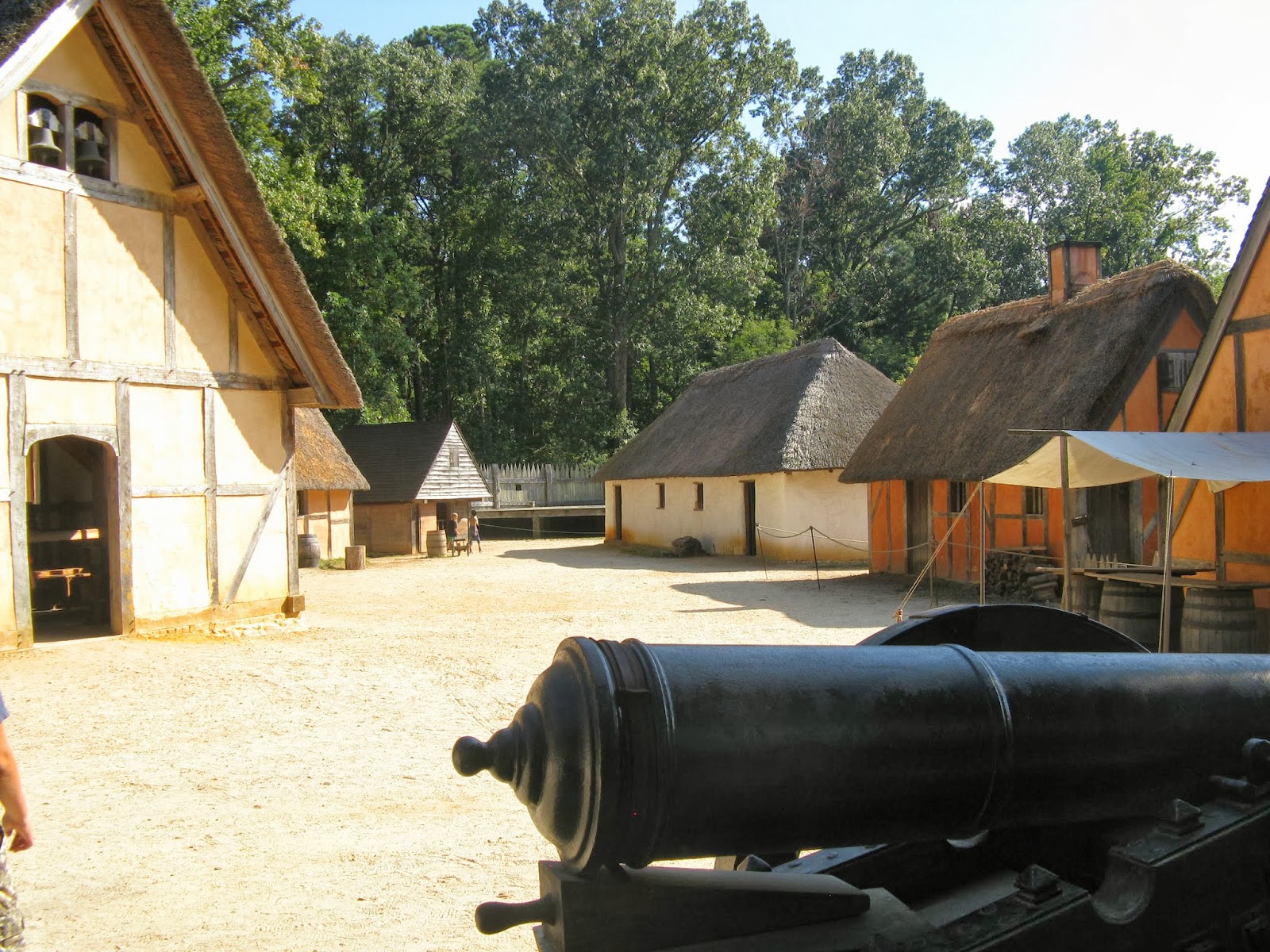
The Colonial Village, set up to show how Jamestown might have looked. 

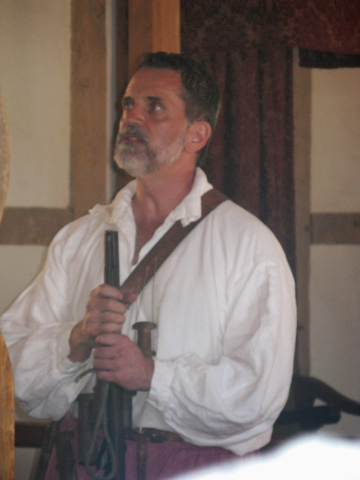
Our colonial tour guide.  I learned so much from him about the church of 1607
and also the preserving of food!  There were other guides around the fort,
showing armour and weapons and the homes, etc.
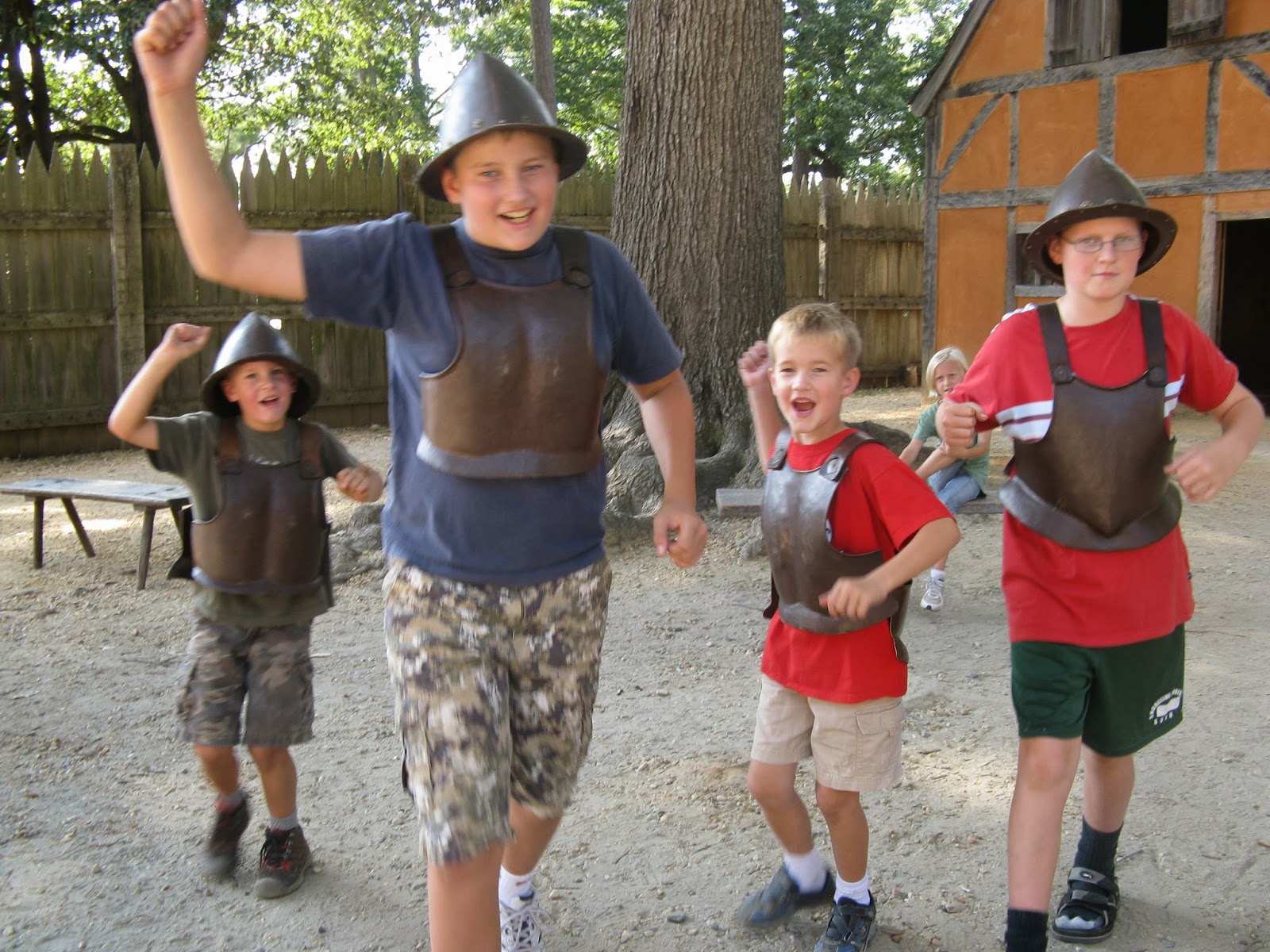
well protected
There was still plenty of excitement in our group to continue onto the third area: the ships.  The museum had created replicas of each of the first three ships to arrive in Jamestown.  Sadly, one of them was off doing an educational program up the river - they try to sail all the ships regularly.  In fact, one of the ships retraced the England-Jamestown trek a few years ago!

Again, there were tour guides on each ship, cheerfully playing the parts, encouraging the kids (and us!) to learn, allowing us to touch and climb and try.  Amazing.
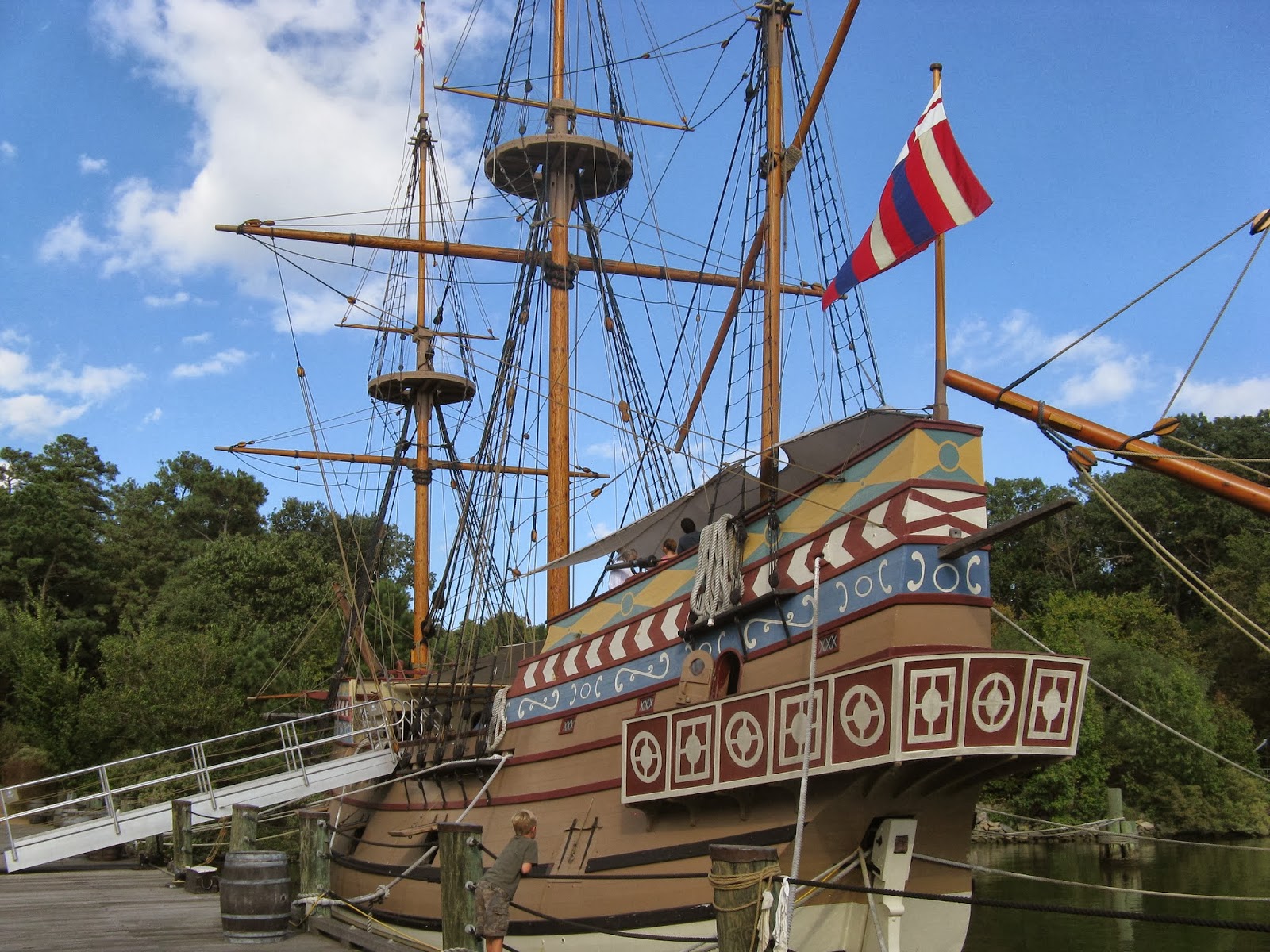
The Susan Constant, as it probably looked in 1607.

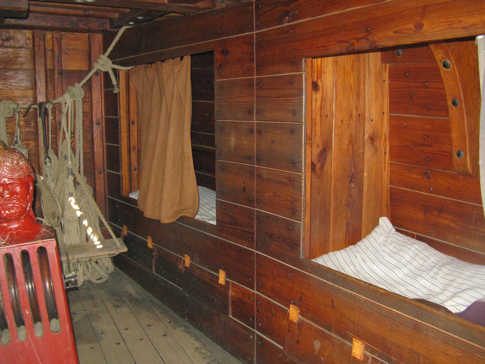
This would have been one crowded ship!
 
I find the complex system of ropes to be so photogenic!

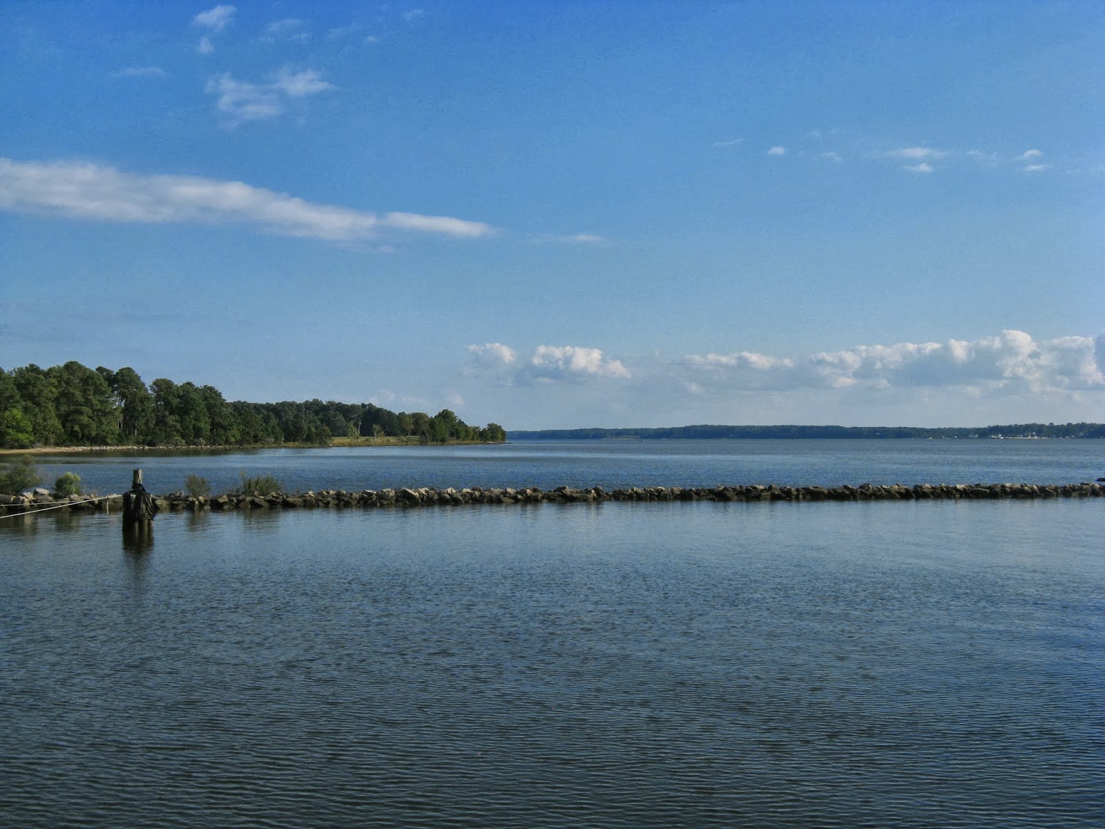
The view from the ships!  James River, looking toward the Chesapeake.

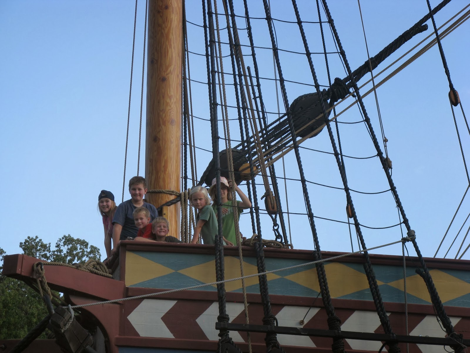
Most of our troop of kids, standing aboard the Susan Constant!


Chatting with a guide aboard the Discovery, the smallest of the ships.
By this point, we were sunned and tired of being on our feet!  We were the last to leave the park.  (Well, the only other visitors at the museum that day were seniors, who probably like to eat supper at four.)  :)  We drove to the colonial village of Williamsburg, where we thoroughly enjoyed supper in a 1750s tavern!  Live fiddling music, waitresses in colonial clothing, racks of lamb, clam soup, hearty ale, candlelight.... what a great end to the day!  (But Jamestown and Williamsburg sure could have kept us occupied for another several days!)

Friday, September 20, 2013

The Settlement of Jamestown (Part I)

In 1607, the first European settlement was established on the shores of Chesapeake Bay.  The place was named Jamestown, in honour of the King of England, James I.  We've been studying the stories of these  settlers forour school, and it was incredible to conclude our unit with a visit to the actual location.  We went to two places; both very meaningful.  First we went to the National Park's site, called the 'Colonial National Historic Park'.  We spent the afternoon at Jamestown Settlement, a 'living museum' built in the fifties.  (I'll post photos of that soon!)  At the National Park site, we met Kim and Gord VanVliet and their kids in the parking lot.  (Kim is Jon's cousin.  We arrived at the exact same time - pretty incredible considering we were both coming from several hours away!)

And so we stood on the same land as the settlers did four hundred years ago!  This is where the people we've been reading about built their homes and dug wells and attended church and endured sickness and hunger!  The site has only recently been discovered/confirmed, and archaeologists are in the process of digging and studying various clues that teach us more about life in 1607.  We were able to talk with some of the archaeologists!  You can click here for more information on the artifacts and discoveries.  So interesting!


I hadn't pictured the area to be so open: the James River was wider than I thought, and the land was quite a peninsula.  Their settlement story is a sad one in many ways.  This was a tough spot to live.  Only 38 of the 104 colonists survived the first year.  Then more settlers came from England to Jamestown: out of 4, 270 people arriving between 1607-1610, three thousand of them died.  In the spring of 1610, the survivors packed up camp and turned their boats toward England.  Enough, already!  Down the river, they met up with a new shipment of boats and people coming from England under the leadership of Lord De la Warr.  (Guess what state is named after him!)  The settlers turned the ship around and headed right back to Jamestown.  

One of the first buildings to be built by the Jamestown settlers was a church - 1607.  The church that we were able to walk through was built in 1907.  The foundation bricks from the 1617 church foundation (the wooden church from 1607 burned down) is evident through some glass flooring.  Really cool! 


cemetery
We weren't allowed to walk around the cemetery, but this
sign was posted to tell us the epitaphs, names and dates, and show
a little map of who was buried where.

It was neat to see a monument made in 1907, which seems like a long time ago to me, celebrating the three hundredth anniversary of the Jamestown Settlement!


The national park had a scavenger hunt/mystery activity for the kids to solve that had them scurrying about and studying things throughout the park.  It was a lovely, quiet Friday - we were about the only ones there!


Linnea had taken quite a liking to the Pocahontas story. 


The museum of archaeological findings was fascinating!  Wish I could show you and describe to you all that we saw there!  Coins, pipes, vases, bones with bullets embedded in them ... really, really neat!

As we wandered through the park back toward our picnic lunch, we came across many such signs and ruins.


 We loved this place!!!   One of my favourite stamps in the National Park Passport!


Saturday, September 14, 2013

Oh say, can you see Fort McHenry?


We went to visit Fort McHenry on Saturday, September 14th.  What a day!  It was the 199th anniversary of the bombardment of the fort during the War of 1812.  Because of the anniversary, the Fort had some fun and meaningful activities.

Many volunteers were dressed in the clothing of the early 1800s.  There were families sharing their daily lives with visitors:


cooking
churning butter

games

There were soldiers all over the fort, playing music, practicing their formation, firing cannons, eating lunch, cleaning up camp, etc.


 The fort itself was very interesting to explore.  Many of the barracks and buildings had exhibits, very well done.  We learned so much!


down into the bomb shelter


What's especially noteable about Fort McHenry is that Francis Scott Key was watching the September bombardment of the fort from the water, wondering all night how the Americans were faring against the British.  Early in the morning, as he saw the flag being hoisted up the fort's flagpole, he was inspired to write the words to The Star Spangled Banner.  I hadn't realized that the flag was not only a symbol of the success of their resisting the bombardment, but also a bold 'in-your-face' statement to the English.  The Americans had earlier presumed that the English would attack here and had a huge flag made ahead of time, stored in a safe place to pull out when the moment was right.


We were especially glad we stayed for the army demonstrations.  Many men demonstrated the clothing, weapons and formations of the soldiers in the battles of the early 1800s.  One man stood on a hill with a microphone, describing what the soldiers were doing and teaching us quite a bit about army life, formations, strategies, etc. 


A good day at Fort McHenry!  (And another stamp for our National Park Passports!)